Photo Realistic 3D Cloud (PRC) Highly accurate subsea measurements solution
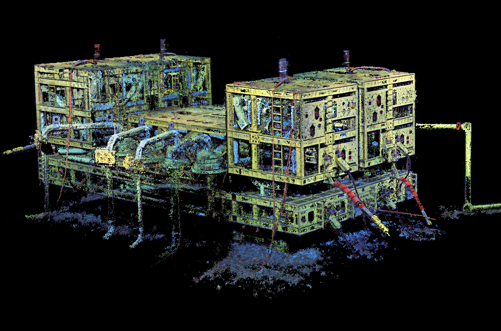
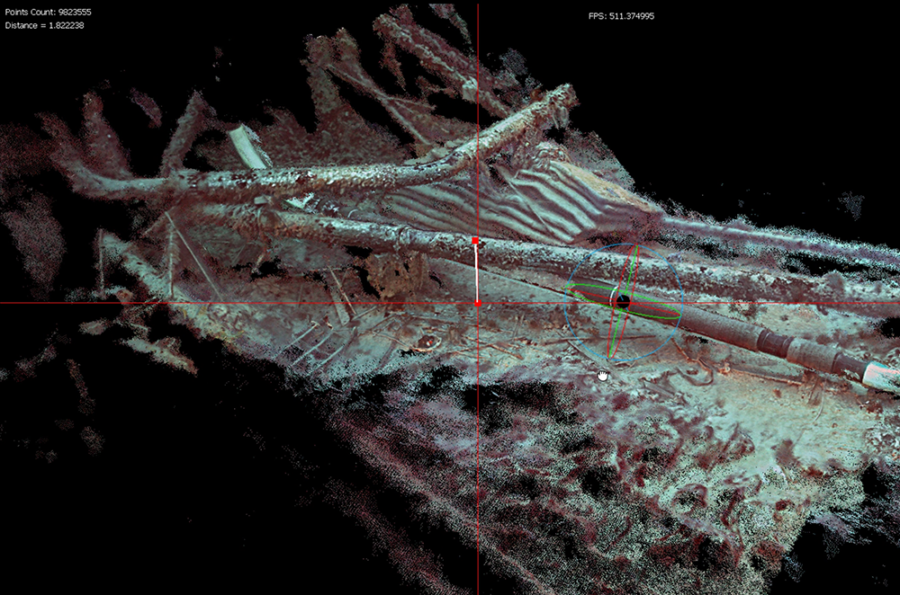
Our PRC is cutting-edge solution that takes inspection to a whole new level. It scans structures and pipeline sections underwater to create a 3D Cloud with millions of points, presenting an as-built, 3D visualization of any scanned object. The system uses breakthrough advanced optical sensors and mathematical disciplines to overcome visibility and positioning challenges. It can also be used onshore or topsides and can be hand-carried for hard-to-reach and congested areas.
75+Metrology projects
6000+3D Point Cloud models
Capabilities
_
The PRC is a precise measurement tool for all structures, pipelines, cables, and umbilical as well as wreck and archaeological seabed sites. It’s fitted to an ROV to overcome inspection challenges, allowing safe access and real-time viewing, even in hazardous and hard-to-reach locations.
Design drawings for subsea structures up to fabrication accuracy.
Gathers a precise 3D reference for dimensions and features including position and orientation for future construction and maintenance.
Geometric assessment.
Pipeline tie-in spool measurements.
Subsea decommissioning survey.
Mooring chain inspection.
Marine growth development rate.
Accurate modeling for buckling or deformation in structure x-members.
Mathematical volume analysis.
Damage volume quantification.
Benefits
_
Increase accuracy
Like the human eye, but without human risk or error, the system gives highly accurate measurements to the nearest millimeter.
Reduce cost
Real time inspection increases efficiency and allows for the faster collection of data, with no need for shutdown, which reduces cost.
Enhance agility
The system is flexible and universal and can be mounted onto any ROV.